UN
35 Sturry Road
£ 113,995
Description
We don't have a Description for this property.
- Bedrooms
- 2
- Bathrooms
- 0
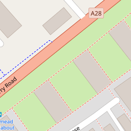

Leaflet © OpenStreetMap contributors
The heatmap indicates the level of crime in the area. The color of the heatmap indicates the crime severity and recency.
Metrics Year-on-Year
- Average area value
- 183,456.00 £Increased by 10.92 %
- Average area rental value
- 818.00 £/moDecreased by 2.27 %
- Est rental Yield
- 5.35 %Decreased by 11.86 %
- Crime Rate
- 13.00 %Unchanged by 0.00 %
from 165,395.00 £
from 837.00 £/mo
from 6.07 %
from 13.00 %
Nearby Schools
| Name | Type | Ofsted | Distance |
|---|---|---|---|
| St Thomas' Catholic Primary School, Canterbury | Voluntary Aided School | Outstanding | 0.65 KM |
| Riverside Children'S Centre (Canterbury) | Children's Centre | 0.70 KM | |
| Canterbury Christ Church University | Higher Education Institutions | 0.72 KM | |
| The King'S School Canterbury | Other Independent School | 0.86 KM | |
| St Johns Church Of England Primary School | Voluntary Controlled School | Good | 0.87 KM |
Images
Nearby Streets
| Name | Average Price | Average Sqft | Distance |
|---|---|---|---|
| Riverside | £ 121,250 | 0 | 0.00 KM |
| Chaucer Road | £ 0 | 0 | 0.00 KM |
| Malthouse Road | £ 0 | 0 | 0.00 KM |
| Duck Lane | £ 90,000 | 0 | 0.00 KM |
| Canterbury Lane | £ 310,000 | 0 | 0.00 KM |
Nearby Transport
| Name | NLC | TLC | Distance |
|---|---|---|---|
| Canterbury West | 5007 | CBW | 1.66 KM |
| Canterbury East | 5164 | CBE | 2.05 KM |
| Sturry | 5029 | STU | 3.92 KM |
| Bekesbourne | 5198 | BKS | 5.83 KM |
| Chartham | 5008 | CRT | 8.60 KM |
Nearby Listings
| Address | Price | Type | Score | Distance |
|---|---|---|---|---|
| Sturry Road, Canterbury | £ 250,000 | BUY | 5 / 10 | 0.03 KM |
| New Town Street, Canterbury, Kent, CT1 | £ 265,000 | BUY | Unknown | 0.05 KM |
| Sturry Road, Canterbury, Kent, CT1 | £ 270,000 | BUY | 7 / 10 | 0.07 KM |
| Starle Close, Canterbury, Kent | £ 175,000 | BUY | Unknown | 0.09 KM |
| Sturry Road, Canterbury, CT1 | £ 120,000 | BUY | 6 / 10 | 0.12 KM |
Nearby Properties
| Address | Price | Distance |
|---|---|---|
| 51 Sturry Road | £ 100,000 | 0.00 KM |
| 35 Sturry Road | £ 113,995 | 0.00 KM |
| 43 Sturry Road | £ 195,000 | 0.00 KM |
| 37 Sturry Road | £ 262,500 | 0.00 KM |
| 73 Sturry Road | £ 95,000 | 0.00 KM |